
To my mind, Doolough is the dark heart of beautiful Mayo. It's a place of dark stories, dark waters and sombre slopes; a place where the skies weep as if for our Famine-era ancestors; a place where light and mountain shift and change under great trailing veils of rain and mist; where wild winds streak the waters with long foamy lines of white and yellow, and where moments of watery sunshine can transform a rocky slope into shining silver.
Equally, Doolough can be a place of picture-postcard perfection, a hushed place of silence and sunshine and swims off its shingled shores. Indeed, over an immensity of time it has felt all the elements of dramatically changing climates; and most familiar was the deep cold of recent glacial periods.
Year-round snows blew incessantly off its high tablelands, eventually transforming their more gentle preglacial slopes and valleys into the battle-scarred but beautifully chaotic place of today, and leaving, wonderfully intact, the narrow but eminently walkable high tableland of the Sheefry Mountains of Co Mayo.
Our plan was a slow ascent of the steep grassy slope to the little col
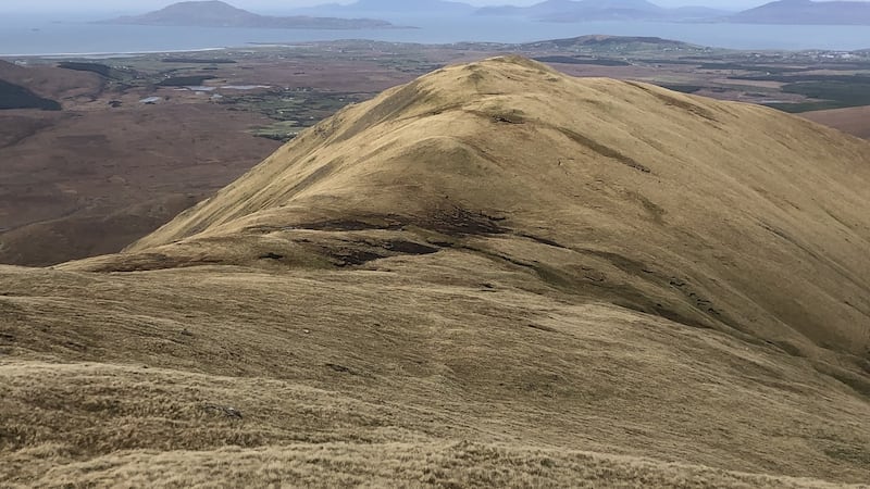
And on a recent winter's day of wind and cold silvery sunshine, we came to traverse this virtual skywalk, with its endless views of mountains, bays and islands and an underfoot litter of stony freeze-thaw. We'd had three great days in the west: Croagh Patrick, Inishbofin and Inishturk, and now we had Barrclashcame (772m) in our sights, the highest point in the Sheefrys.
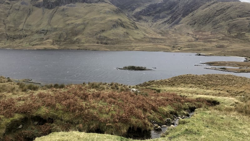
Our starting point was the northern shore of Doolough, just opposite “Hut Island”, and our plan was a slow ascent of the steep grassy slope to the little col between point 580m and the northwest approach to Barrclashcame. Parking spaces were ample, access from the road was clean and trouble free, and underfoot conditions were excellent.
We regrouped on the col after more than an hour of climbing, noting the increasingly rock-strewn and steepening access to the summit plateau. By now we were being treated to lovely vistas to the north and northeast, to Nephin, Croagh Patrick and all the islands right around to Inishbofin in the west – a view to die for were it not for a freezing force-6 windchill! We picked our way easily up the rocky slope and on to the summit, benefitting briefly from the shelter afforded by the escarpment edge.
Soon the retreat was sounded and we were back at the col for lunch
The summit was nowhere to linger that day. The long and inviting “ridge” to the east, and the great vistas in every direction, were duly admired in wind-snatched exchanges. Soon the retreat was sounded and we were back at the col for lunch, some then continuing beyond point 580m and finding an easy descent to the road.
Others went straight down, but I stayed behind nursing a badly pulled thigh muscle.The only positives were enforced stops and plenty of time to feel the wonder of where I was, and especially of Mweelrea before me across the dark waters of Doolough.
Walk for the Weekend: Doolough and the Sheefrys, Co Mayo
Map: OS Sheet 37
Start/Finish: Northeast corner of Doolough, about 13km south of Louisburgh on R335
Effort: 4 to 5 kms; 740m of climbing; 3½ hours
Facilities: Delphi Resort (including cafe/coffee shop), about 4km south on R335


