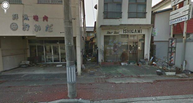
The eerily empty streets of Namie, a town deep in the evacuation zone around the crippled Fukushima Daiichi nuclear power plant in Japan, are featured in the latest images captured by Google for its Street View mapping project.
The scene is wrenching: houses flattened by the earthquake and now abandoned for fear of radiation; rows of empty shutters on a street that once hosted Namie's annual autumn festival; ships and debris that still dot a landscape laid bare by the 50-foot waves that destroyed its coastline more than two years ago.
Namie's 21,000 residents are still in government-mandated exile, scattered throughout Fukushima and across Japan. They are allowed brief visits no more than once a month to check on their homes. Another 90,000 people remain unable to return to their homes in the exclusion zone. Experts and government officials have said that some of the most heavily contaminated areas in the exclusion zone might be uninhabitable for years, or even decades.
0 of 5


Invited by Mayor Tamotsu Baba to document the town's deserted streets, Google began mapping Namie earlier this month. It used a car fitted with a camera that captures a 360-degree view of its journey.
Google has mapped other parts of Japan's tsunami zone, but the scenes released Wednesday were the first from within the exclusion zone.
"Many of the displaced townspeople have asked to see the current state of their city, and there are surely many people around the world who want a better sense of how the nuclear incident affected communities," Baba said in a blog post on Google.
Mr Baba, as well as Namie's town hall operations, remains evacuated in Nihonmatsu, a city about 30 kilometers inland. "Ever since the March disaster, the rest of the world has been moving forward, and many places in Japan have started recovering," he said. "But in Namiemachi, time stands still."
New York Times