
Are you yearning for a liberating post-lockdown challenge? An escape from the crisis-ridden realities of the 21st century, and a return to something memorable and meaningful? Opportunities for such adventures abound, according to innumerable glossy travel brochures: Machu Picchu, Everest Base Camp, the Appalachian Trail… But up there with the best of them, without the hassle of airport queues or the guilt that comes with a gas-guzzling long-haul flight these days, is a challenging and unforgettable adventure right on our doorstep.
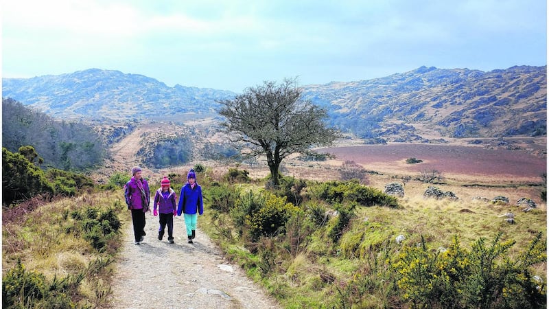
Starting and finishing in Killarney, the Kerry Way is one of the world’s most diverse and spectacular trails, meandering through a wild and exuberant landscape that mostly feels unhitched from modernity. Along the way, it glides by dramatic peaks and windswept loughs, encountering glorious glens, wild moorlands and captivating coastal vistas.
Traditionally, it is broken into nine stages, and there is no doubt that completing the entire route is a considerable test of endurance. There’s also the more agreeable option to complete the way over several more leisurely visits, while making time for side excursions en route.
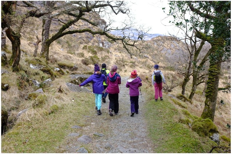
It is important to understand that the Kerry Way isn’t just one route, but offers a confusing maze of alternative trails. With this in mind, the route here is devised for first-timers. This is a long-distance trail through often wild and exposed terrain where the unexpected can happen, so the advice is to think optimistically, but prepare pessimistically.
READ MORE


Killarney to Black Valley: 24km
From Killarney Tourist Office, follow the walking arrows to the Muckross Road and along a pedestrian path to Killarney National Park. The path tags the shoreline of Lough Leane before passing Muckross House and continuing to the towering cascade of Torc Waterfall. Beyond is your first taste of freedom from the 21st century; crowds soon evaporate on what was once the coach road to Kenmare.
Continue through secluded Esknamucky Glen and the ancient oakwood of Derrycunihy to reach a junction. Go right here, cross the N71 and descend through woodland and by the shore of the upper lake to the tearooms at Lord Brandon’s Cottage. Beyond, the route follows a minor road for 3km to reach the Black Valley Hostel.

Black Valley to Glencar: 18km
From the hostel, continue southwest through the Black Valley. Then follow rougher tracks that ascend to a pass. Descend into the magnificent Bridia Valley and continue roughly west-southwest to a minor road. Head west to reach the remotely situated Cooky Monsters Cafe. Here, the way leads right and uphill along an ancient trade route known as the Lack Road. At the high point, you will enjoy superb views over the Reeks and Lough Acoose. Next, the way drops for about 2km, until it divides at a stile. Go left over undulating terrain that alternates between woodland and ancient field systems to a public road. Follow this left to the Climbers Inn, Glencar.
Glencar to Glenbeigh: 14km
Opposite the Climbers Inn, follow a gravel lane to a minor road and continue over the River Caragh. The trail now alternates gently between riverside paths, quiet roads and forest lanes. Eventually, it divides at a superb viewing point over Caragh Lake, offering a choice of a track over the Windy Gap or a longer loop on minor roads. I prefer the Windy Gap, which is mainly off-road and offers unforgettable views. Beyond, the track veers downhill to a road. Continue to a T-junction where Glenbeigh village is 1km to the right.
Glenbeigh to Cahersiveen: 20km (assuming a taxi from Teeraha to Cahersiveen)
Leaving Glenbeigh, cross the river Behy and follow the signs to the Fairy Forest. Above this, there’s another choice of route. I prefer the coastal option, which offers beguiling views over Rossbeigh beach to the Dingle mountains. Follow this and turn left along the R564 to continue along quiet lanes before crossing over the Ring of Kerry road. You are now away from it all. An old coach road, which was once the main route to south Kerry, hugs the flanks of Drung Hill for 7km. This offers beguiling views of the Dingle Peninsula and Blasket Islands before descending in to the Ferta valley. Here bucolic tracks, quiet roads and field paths convey you to another division in the route showing a spur for Cahersiveen. To avoid a 10km slog, it is probably best to call a taxi to Cahersiveen here.
Cahersiveen to Waterville: 25.5km (assuming a start from Teeraha)
If you want to avoid another slog, your accommodation provider may, for a small charge, drop you back to the Kerry Way at Teeraha. Here, the route climbs to gain a ridge and afterwards the fantastic 360-degree viewing point of Coomduff. You are now exposed to the most isolated part of the way, on an exhilarating crest, crossing another minor summit before descending to Coars. A steep climb now leads to another up-and-down ridge that reaches 371m at Knockavahaun – the highest point on the way. Descend to a road and when a choice of routes is offered, follow the Kerry Way markers right to Mastergeehy. Opposite a derelict school, go left past an abandoned church and tag the waymarkers off-road to gain a path junction. Here the waymarker pointing left refers to the inland route to Caherdaniel. This is tough and isolated, and my recommendation is that first-timers continue to Waterville. Keep right, therefore, and climb to the crest. Follow this and then trend left to gain the public road leading into Waterville.
Waterville to Caherdaniel: 12km
You will doubtless be glad to learn that today is short but captivating. Follow the Ring of Kerry south from Waterville. Go right to tag minor roads for about 3km until the path dives left and off-road as the way tracks a deep valley, before ascending to the busy N70. Beyond, the track leads to a high point. You cannot but be entranced by the great vista here: Derrynane Bay, the islands of Deenish and Scariff, the wistful mountains of Beara beyond. Descend to recross the N70 and continue to a minor road where there is another route choice. My recommendation is to go right for about 3km to Bunavalla Pier. Afterwards, follow signs through captivating coastal terrain to reach Derrynane House and Tearooms, which was once the home of Irish liberator, Daniel O’Connell. Continue afterwards to Caherdaniel.
Caherdaniel to Sneem: 17km
From Caherdaniel a green road winds uphill to a crest. Continue past where an inland route of the way joins from the left. Beyond, alternating hill tracks, paths and minor roads lead 10km to the N70. Along the way, there is the option of a 1.5km diversion to Staigue Fort – one of the largest and most impressive Irish pre-Christian fortresses. The main road diversion is mercifully short, and the way soon returns to a mixture of green tracks and back roads before joining a gun-barrel straight lane for the final 2km to Sneem.
Sneem to Kenmare: 34km
The longest stage on the way begins from South Square. Minor roads and lanes lead to a wooded area where the trail passes Brushwood Studios, the secluded gallery of the Muller family. Beyond, you reach the N70 and turn left and then right to a minor road. Soon, a gravel road heads left for 2.5km to Tahilla. Here, an old trade route canters for 6km above the Ring of Kerry before reaching a road to Blackwater Bridge. Beyond, the path wanders through dense woodland, sometimes by the shoreline of Kenmare Bay and sometimes inland, before depositing you to the N70. After 500m, the way follows back roads in a 6.5km loop above Templenoe. I usually follow the shorter N70, going with care past Templenoe, turning left at a crossroads and afterwards swinging right. Now it is off-road trails that convey you 7km past the superb viewing point of Gortamullin before the route descends to re-join the Ring of Kerry Road just outside Kenmare.

Kenmare to Killarney: 25km
From Kenmare Square, head north along Old Killarney Road. This rises steeply across the flank of Strickeen Hill before continuing to a crossroads. Continue straight along a track – that was once the road to Killarney – as it climbs to a second Windy Gap. Descend the rocky track with many stream crossings to reach a minor road. Just beyond is the path junction that you passed on your first day’s walking, so congratulations, you have now completed the Kerry Way. For your return to Killarney, you may retrace your steps along the way or take the short walk to Galway’s Bridge and a taxi to Killarney.
Tip: One option for shortening the way is to cut out the inconvenient Cahersiveen overnight. This works best if you stay at Dromid Hostel near Mastergeehy, but involves a 33km day if starting from Glenbeigh. A better option is to extend the previous section beyond Glenbeigh and overnight at Mountain Stage (Mountain View, B&B) for a more manageable 27.5km to Dromid Hostel. You then face only a short outing the next day, giving you plenty of time to savour Waterville.
What you need to bring
• Waterproof rucksack
• Comfortable walking boots
• Specialist walking socks – several pairs
• Waterproof jacket and over-trousers
• Inner clothing in layers
• Gaiters, hat and gloves
• Guidebook, maps, compass and GPS
• Water carrier
• Food to last between supply points
• First aid kit, including blister aid
• Insect repellent and sun protection
• Cash in euros: cash machines are scarce
• Whistle (if you are walking alone)
• Mobile phone
The Kerry Way, by Sandra Bardwell and John G O’Dwyer, offers a comprehensive guide to the full route with detailed maps, available in bookshops and from rucsacs.com


