
This is a perfect route for cyclists who like the quieter side of life. On offer are single-track lanes, leafy village roads, stunning mountain views and glimpses of the impressive Caragh Lake.
The route starts in the mid-Kerry village of Milltown, a 20km drive from both Tralee and Killarney. A good option for parking is the Castlemaine end of the village, close to the post office.
Leaving the start point, cycle on the N70 in the direction of Killorglin. Follow the bend in the road and the climb out of the village. Take the first left turn onto the road signposted Lyre/Recycling Centre. This section of road is relatively flat and runs through a rural and rugged landscape. About 4.4km from Milltown, take the left turn at the second crossroads, heading east. The road is unmarked, but known locally as the Kerry Woollen Mills road.
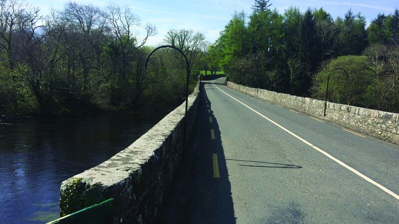
Continue eastwards for 2.5km; proceed straight over the crossroads, on a road called Lahard Cottages. At this point the road narrows slightly and the surface becomes a little uneven. The route reaches a T-junction at Faha Glen. Turn right and continue on as the road descends steadily towards the N72 Ring of Kerry route. On reaching the T-junction with the N72, turn right and cycle for a short distance before taking the first left towards Beaufort. Cycle over the stone bridge before taking the first road to the right, signposted for Killorglin and Beaufort Golf Club.
Stone bridge
Continue on through this neat little village before passing the entrance to Beaufort Golf Club, 2.5km on. Take the left turn, signposted Churchtown burial grounds, and continue along this leafy stretch of road before crossing the stone bridge that straddles the river Gaddagh. From here on the panorama opens up, with distant views of Carrauntoohil over to the southwest. Enter the village of Kilgobnet and proceed straight through, keeping very much to the left at the fork at the far end of the village.
This next stretch is initially narrow as it bypasses small dwellings and farmsteads, continuing over another stone bridge before arriving at Shannera Cross, about 2km from Kilgobnet. This crossroads is unmarked. Take the left turn between the grotto and an old white house and proceed up a steady climb. This stretch of the route cuts through a forested area with great views of Carrauntoohill. From here, the route meanders down to meet the Glencar-to-Killorglin road, where we turn right.
Continue for 1km in a southwesterly direction before reaching a unique road sign that points the way to eight different destinations. Take the right turn for Killorglin, scaling up another steady climb for 6km. This area is barren but gives off a warm, golden glow in the sunshine as the road rises gently through scrub and bogland.
Once at the next major crossroads, indicated by the sign for Ardrahan House B&B, take the left turn for Cappanalea and enjoy a steady 2.5km descent. At the next T-junction, take the right turn. Avoid at all costs the steep hill and the left-hand road sign pointing to Cappanalea. Along this section, the road narrows and passes through a wooded area. This soon gives way to a few twists and turns before merging onto a T-junction close to Glannagilliagh National School. Take the left turn and go straight past the small general shop, in the direction of Carrig Country House and Glenbeigh.
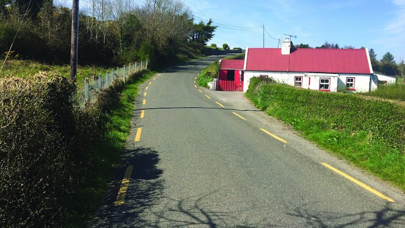
Bite to eat
On this section of road Caragh Lake can be seen to the left. Take the right turn by the sign at the entrance to Glendalough Country House and continue up to the next T-junction. Take a right turn onto the N70 and take the main Ring of Kerry road into Killorglin for about 6km. Killorglin, which is famous for its Puck Fair, is an ideal place to grab a break and a bite to eat.
Passing through Killorglin, follow the signs for Tralee and proceed over the impressive Laune Bridge. At the mini-roundabout take the first exit for Tralee and continue on the N70 for 3km. Take the left turn for Callanafersy and follow the straight, narrow road down to the pier and slipway.
From here take in the views of Castlemaine harbour, the Slieve Mish Mountains and Inch strand. In the last century this was the disembarkation point for a small ferry that ran between Callanafersy and Keel on the opposite bank.
Retrace the route for 1km and take the unmarked road to the left. The landscape changes from open farmland to forest, with the road running very straight and flat. Proceed up the slight incline through a canopy of trees and rejoin the N70 close to Milltown. Take the left turn up the hill and pass the cemetery, before dropping down into Milltown and back to the starting point.
Route 12 King Puck Route
Milltown – Beaufort – Kilgobnet – Lough Caragh – Killorglin – Callanafersy – Milltown
Peaceful laneways and roads, set against a stunning Carrauntoohil backdrop.
Grade: 3
Distance: 62km
Height gain: 428m
Time: 3 to 4 hours
Climbs: No major climbs on this route
An extract from Cycling Kerry – Great Road Routes by Donnacha Clifford and David Elton (The Collins Press €14.99), available from all good bookshops and online from collinspress.ie.


