

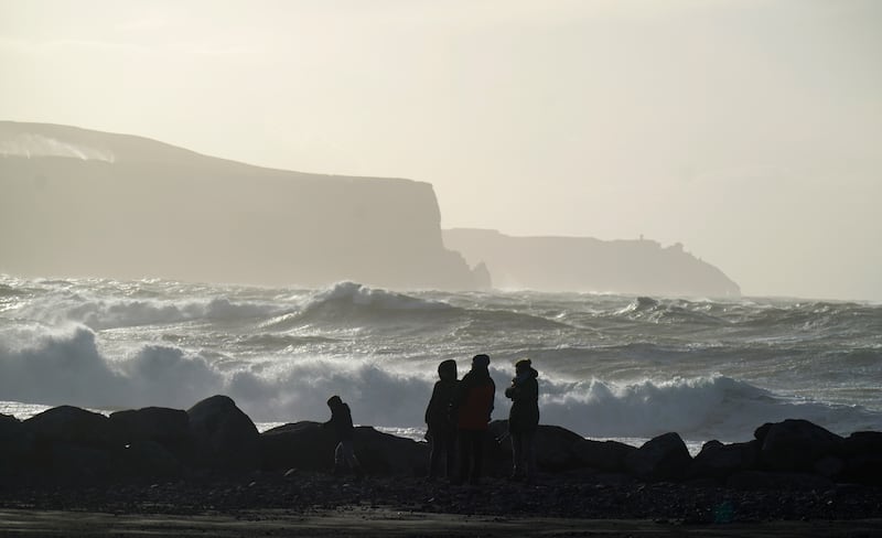
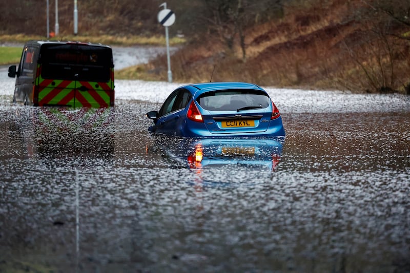
Ireland is experiencing a sustained period of storminess with seven named storms in just four months, including storm Gerrit which hit hard between Christmas and the new year.
The storm season is charted on a September-to-September basis. In this part of the world, Met Éireann along with the UK Met Office and KNMI in the Netherlands jointly release new storm names for each season. Then, based on weather forecasts, each can then name a storm if meteorological conditions suggest an oncoming Atlantic weather system is likely to have widespread impact within their jurisdiction.
Storm Gerrit followed Agnes, Babet, Ciaran, Debi, Elin, Fergus, and is the earliest G-named storm since the naming initiative began in 2015. Since then there have been on average eight named storms in a season. The most occurred in the 2015-2016 and 2017-2018 seasons, each with 11 – the lowest was four in 2022-2023.
Other national meteorological services in the US and Europe also name storms. When any national met service names a weather system, others keep that name. This includes ex-hurricanes named by the US National Hurricane Centre such as Charley (August 1986) and Ophelia (October 2017), which caused much destruction in Ireland.
READ MORE


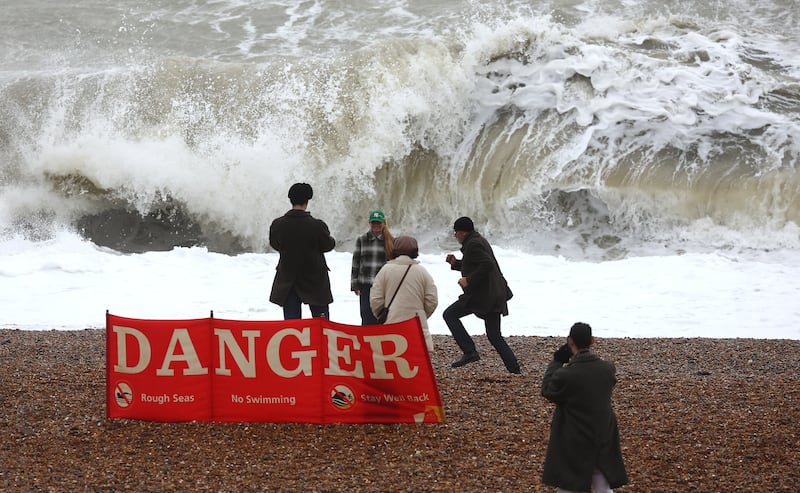
Storm Gerrit was named by the UK Met Office based on its prediction of the impact it would have on Scotland. It brought high winds and intense rain, causing widespread destruction, flooding, power outages and transport disruption.
“Storm naming is an important asset in our warnings arsenal and makes severe weather communications clearer and more effective. It connects our weather services more closely to the public, helping us in our mission to protect lives and property and ensuring the safety of our communities,” according to Eoin Sherlock, head of forecasting division in Met Éireann.
A high level of storminess has meant more frequent and intense storms hitting Ireland, but attributing this over a relatively short period to a warming world is impossible to say definitively, adds Dr Keith Lambkin, Met Éireann’s head of climate services. That link can only be made looking back at patterns over many decades.
Unlike temperature, which is clearly defined, he says “a storm is tricky to measure”. Named storms are based mainly on impact on citizens. Others might be classified based on physical impact – but not necessarily severe wind speeds – or low pressure in weather systems, “but that could be far out to sea”. That means it’s also difficult to say how much storms have changed, “because we all have different ways of measuring them”, Lambkin says.
Met Éireann has a “storm centre” which charts storms once data is verified including highest sustained/mean wind speed, highest gust, highest total rainfall, sea surface pressure and highest individual wave off the coast.
The most reliable research on whether global warming is exacerbating storminess has been conducted by climate scientists under the United Nations Intergovernmental Panel for Climate Change (IPCC). It suggests northern Europe, including Ireland over the next 50-100 years, can expect more severe storms but of decreased frequency, but this is with “medium confidence” – their way of indicating likelihood.
Tropical cyclones, powerful storms that develop in warm ocean waters of the tropics, frequently hit the headlines and bring after-effects to Europe. In 2017, a string of major hurricanes – including Harvey, Irma and Maria – caused devastation in the US and Caribbean.
Quantifying the climate effect on such storms is “challenging”, the IPCC has concluded, “partly because extreme storms are rare, short-lived and local”, but also because individual storms are influenced by a “high degree of random variability”. However, despite these challenges progress is being made with better climate modelling and use of AI.
Its AR6 report concludes “it is likely that the global proportion of category 3-5 tropical cyclone instances and frequency of rapid intensification events have both increased globally over the past 40 years”. These “major” storms – reach sustained wind speeds of 111 miles per hour or more.
While there is no clear evidence climate change is increasing or decreasing storm frequency, there is strong evidence increasing sea temperatures increase intensity of tropical storms when they develop. Heavier rainfall is also expected as global temperatures rise because a warmer atmosphere holds more moisture. Additionally, rising sea levels increase risk of coastal flooding as they make landfall. The same applies to Atlantic storms hitting Ireland.
Further complicating matters, Lambkin says, is the chaotic nature of the atmosphere enveloping the Earth, which brings randomness to our weather.
[ Ireland weather: Status yellow warnings for 11 counties amid rain and strong windOpens in new window ]
There is, however, one indicator of the cause of high storminess; the atmospheric circulation pattern known as the North Atlantic Oscillation (NAO). This is an index reflecting the difference between low pressure anchored over Iceland and high pressure over the Azores. When it’s high (a positive NAO index), westerly airflow over the Atlantic strengthens and a series of storms are directed over northern Europe.
“This was one of the main causes of the high storminess in the 1910-1920s and 1980-1990s, and is a factor that continues to influence the year-to-year and decade-to-decade storminess variability in Ireland,” explained climatologist Dr Lisa Orme of Maynooth University recently.
Weakening of vital ocean currents is another disturbing trend, notably the shutting down of the Atlantic Meridional Overturning Circulation (Amoc).
Part of the Gulf Stream which gives Ireland a benign climate, it was known to be at its weakest in 1,600 years owing to global heating. But in 2021 researchers spotted warning signs of a tipping point. Its collapse would have disastrous consequences, severely disrupting rains that billions of people depend on for food in India, South America and Africa, and increase storms and drop temperatures in Europe.
The one reassurance amid terrible uncertainties and increased volatility is ever-improving ability to predict weather. Better localised forecasting and a much-delayed new flood forecasting and warning system is being developed by Met Éireann, deploying updated technology systems including supercomputers. It will at least improve preparedness in advance of approaching storms.
- Sign up for push alerts and have the best news, analysis and comment delivered directly to your phone
- Find The Irish Times on WhatsApp and stay up to date
- Our In The News podcast is now published daily – Find the latest episode here


